Why Do Current Models Fall Short in Real-World Applications?
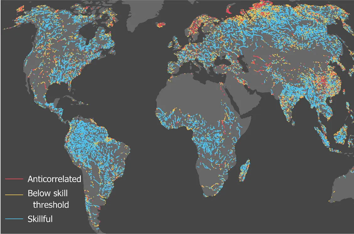
A team of hydrologists at the University of Massachusetts Amherst has found that widely used river models often produce inaccurate results when compared to real-world satellite observations. Colin Gleason, a hydrologist in the Riccio College of Engineering, led the analysis using newly accessible data from Earth-observing satellites. The discrepancies raise concerns about how water availability, flood risks, and hydropower operations are predicted in a changing climate. These findings come as water managers increasingly rely on models to make critical decisions about reservoir releases and infrastructure planning.
The study compared model outputs with actual river height and flow measurements derived from satellite altimetry and imagery. In many cases, the models failed to capture seasonal variations or extreme events accurately, particularly in basins with complex terrain or limited ground monitoring. Gleason explained that the mathematical assumptions underlying these models often oversimplify river dynamics, such as sediment movement or floodplain interactions. As a result, predictions for water supply or hydroelectric generation can be significantly off, sometimes by more than 30 percent during peak flow periods. The researchers emphasized that improving model physics—not just increasing computational power—is essential for better accuracy.
How Can Satellite Observations Improve Future Water Management?
Many river models rely on simplified equations that assume uniform channel shapes and steady flow conditions, which rarely exist in nature. Satellite data revealed that models frequently underestimated flow during monsoon seasons and overestimated it during droughts, leading to flawed water allocation decisions. Gleason noted that models calibrated using sparse ground sensors often perform poorly when applied to ungauged basins, which make up the majority of global river systems. The integration of satellite observations offers a way to validate and adjust these models across larger spatial scales. However, challenges remain in processing the vast volumes of data and aligning them with model timesteps.
By incorporating real-time satellite data, models can be continuously updated to reflect actual river conditions, improving forecasts for floods and droughts. This approach could help hydropower operators optimize turbine use and reservoir managers avoid over-release or dangerous shortages. Gleason suggested that combining satellite inputs with machine learning techniques might allow models to adapt dynamically to changing land use and climate patterns. The research team is now working with federal agencies to test this hybrid approach in the Colorado and Mekong river basins. Early results show promise in reducing forecast errors by up to half in pilot regions.
What specific satellite data were used in the study? The researchers used radar altimetry from missions like Jason-3 and Sentinel-3, along with optical imagery from Landsat and Sentinel-2, to measure river height, width, and flow dynamics over time.
Frequently Asked Questions
How often do current river models produce significant errors? In basins with limited ground data, model errors can exceed 30 percent during high-flow events and vary seasonally, according to comparisons with satellite observations.
Can satellite data fully replace ground-based monitoring? No, satellite data complement rather than replace ground sensors, which provide critical local details; however, satellites offer broader coverage where gauges are absent or sparse.